


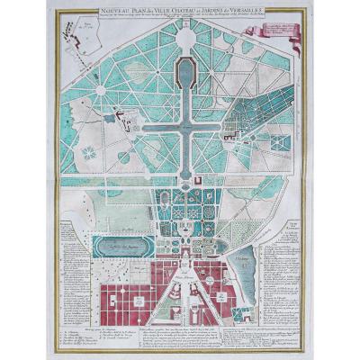
large original plan made in 1724. Edited by Demortain in Paris.
Beautiful watercolor colors.
Redness in the upper margin not reaching the engraving.
Ancient handwritten outlines in the labyrinth with a freckle on the letter D.
Good condition.
Sheet size: 64 x 51 cm.
Engraving format: 56.5 x 42 cm.
New particularly detailed plan with remarks from A to S for the gardens and from 1 to 8 for the Château.
You can consult all the maps, books and engravings available in your region by clicking on the link of our website specializing in ancient geographic archives:
https://cartes-livres-anciens.com/categorie-produit/cartes-geographique-anciennes-original-antique-maps/france/ile-de-france-78-versailles/
Secure payment by credit card on our website:
https://cartes-livres-anciens.com/produit/cartes-geographique-anciennes-original-antique-maps/france/ile-de-france-78-versailles/plan-ancien-de-la-ville-chateau- and-gardens-of-versailles-gardens /
All our maps and engravings are accompanied by a certificate of authenticity.
Old plan of the city - Palace and gardens of Versailles


Send to a friend


 +33(0)6 12 89 90 97
Contact Patrick Serouge
Patrick Serouge
www.cartes-livres-anciens.com
Marché Serpette
Allée 4 Stand 15
Allée 4 Stand 15
+33(0)6 12 89 90 97 pserouge@cartes-livres-anciens.com
 www.cartes-livres-anciens.com


