

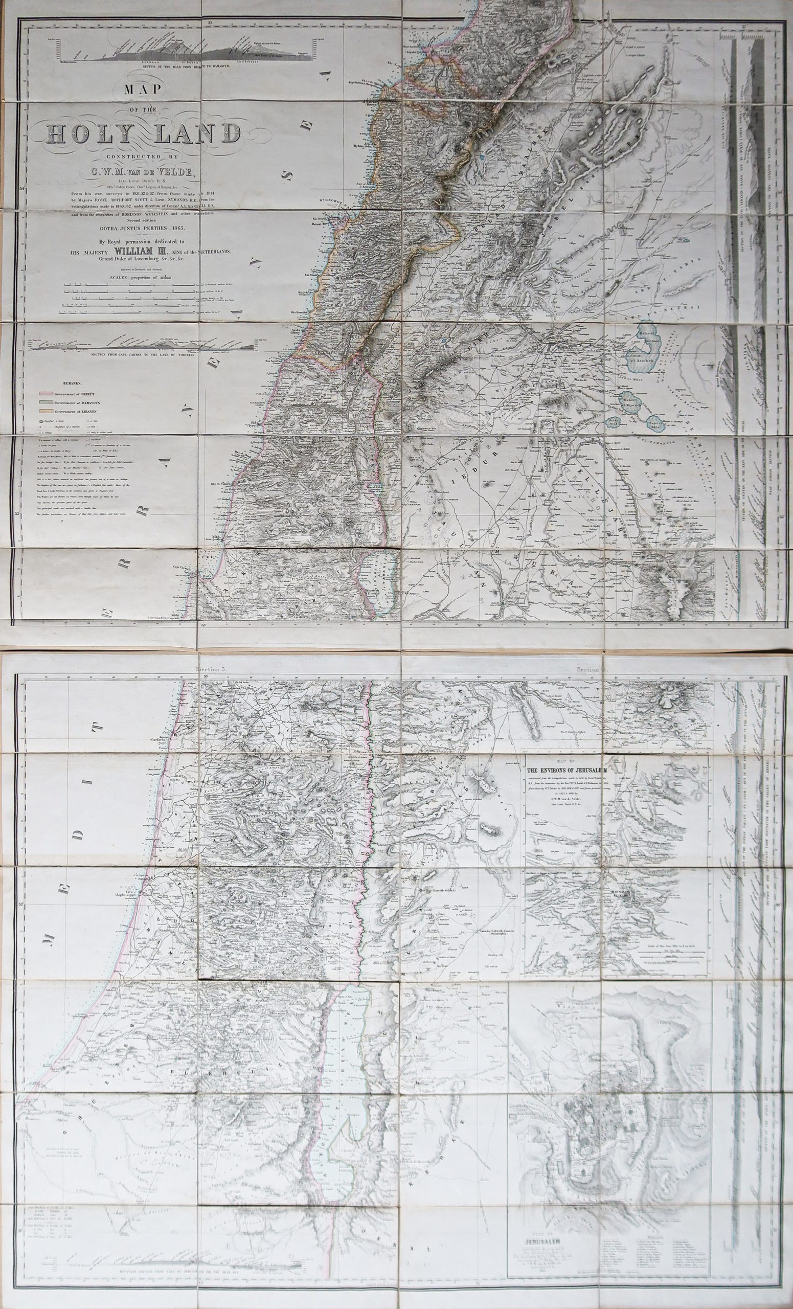
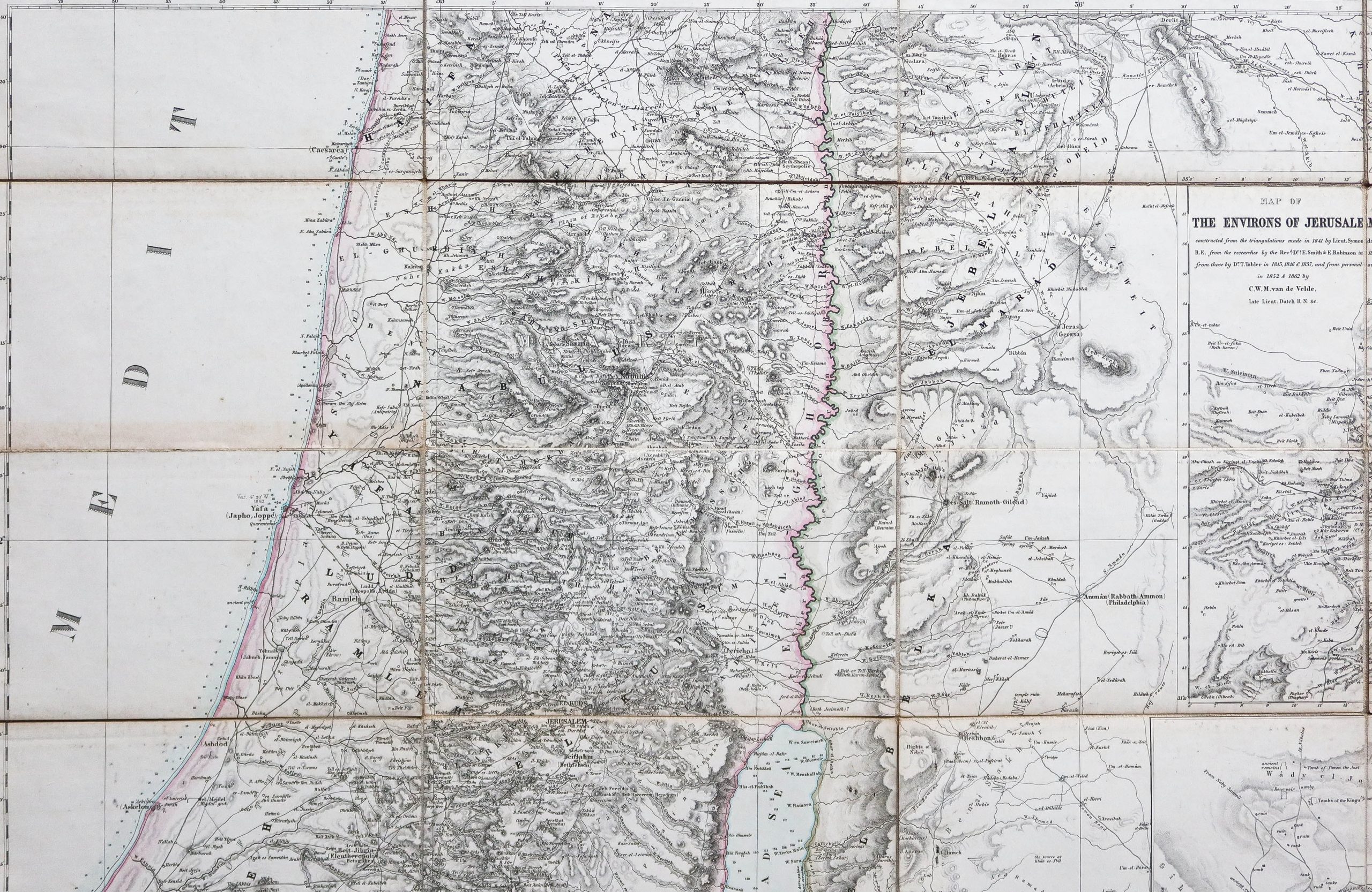
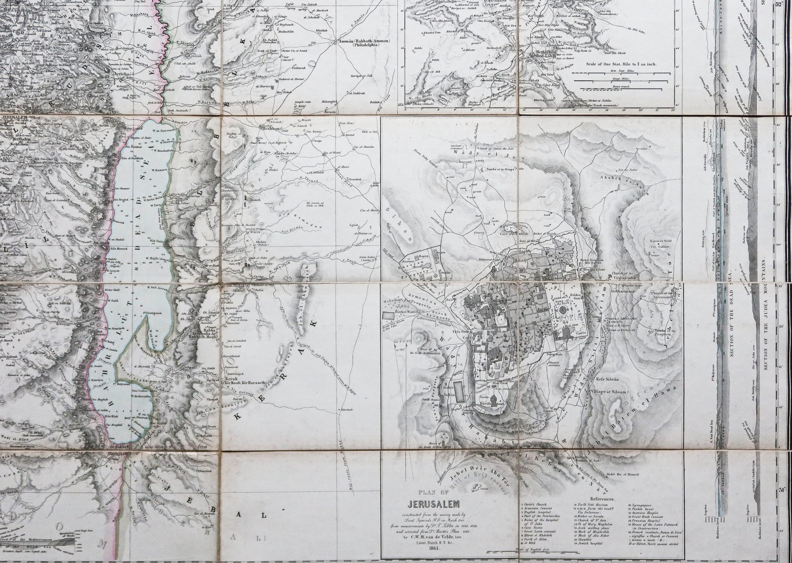
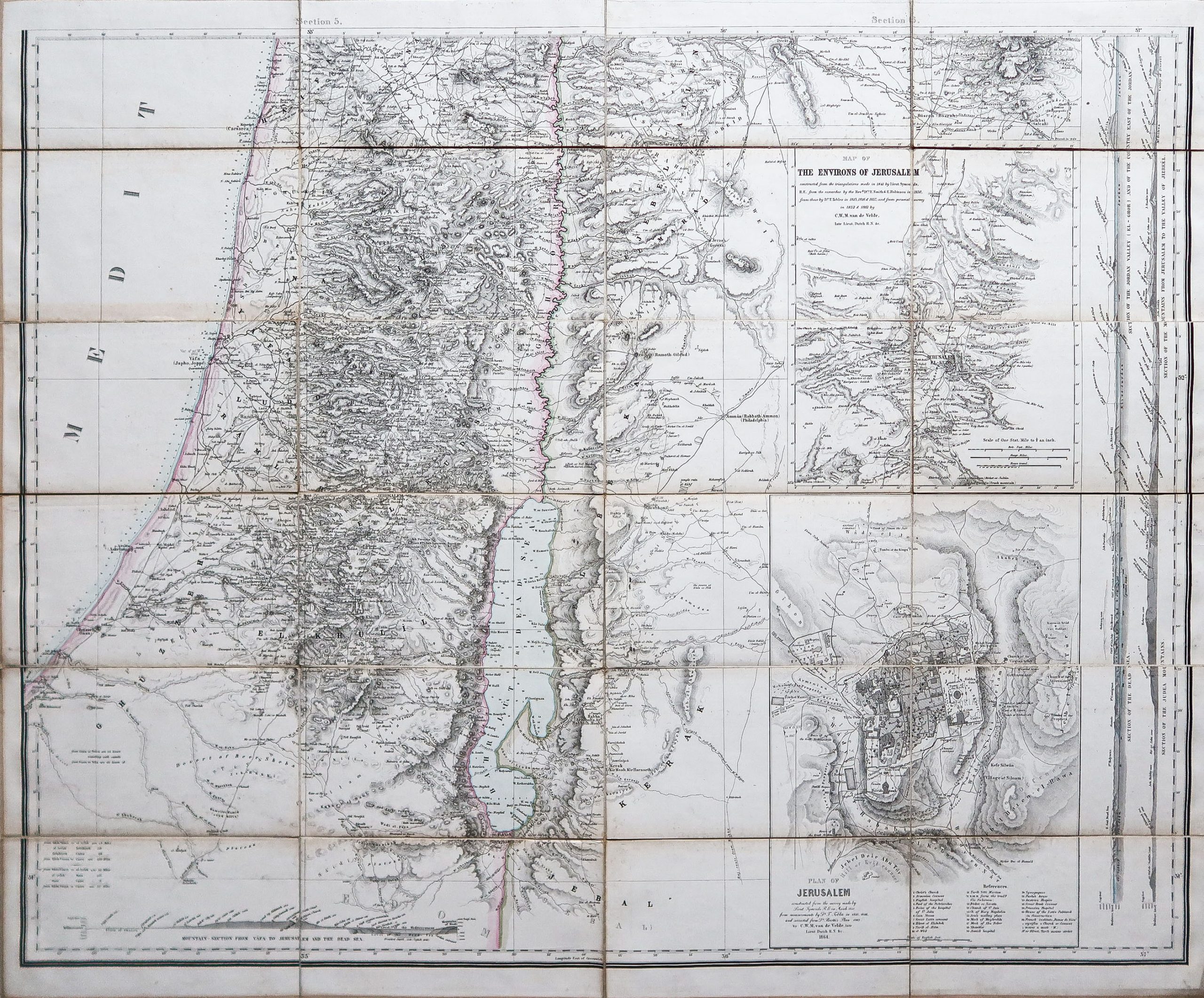
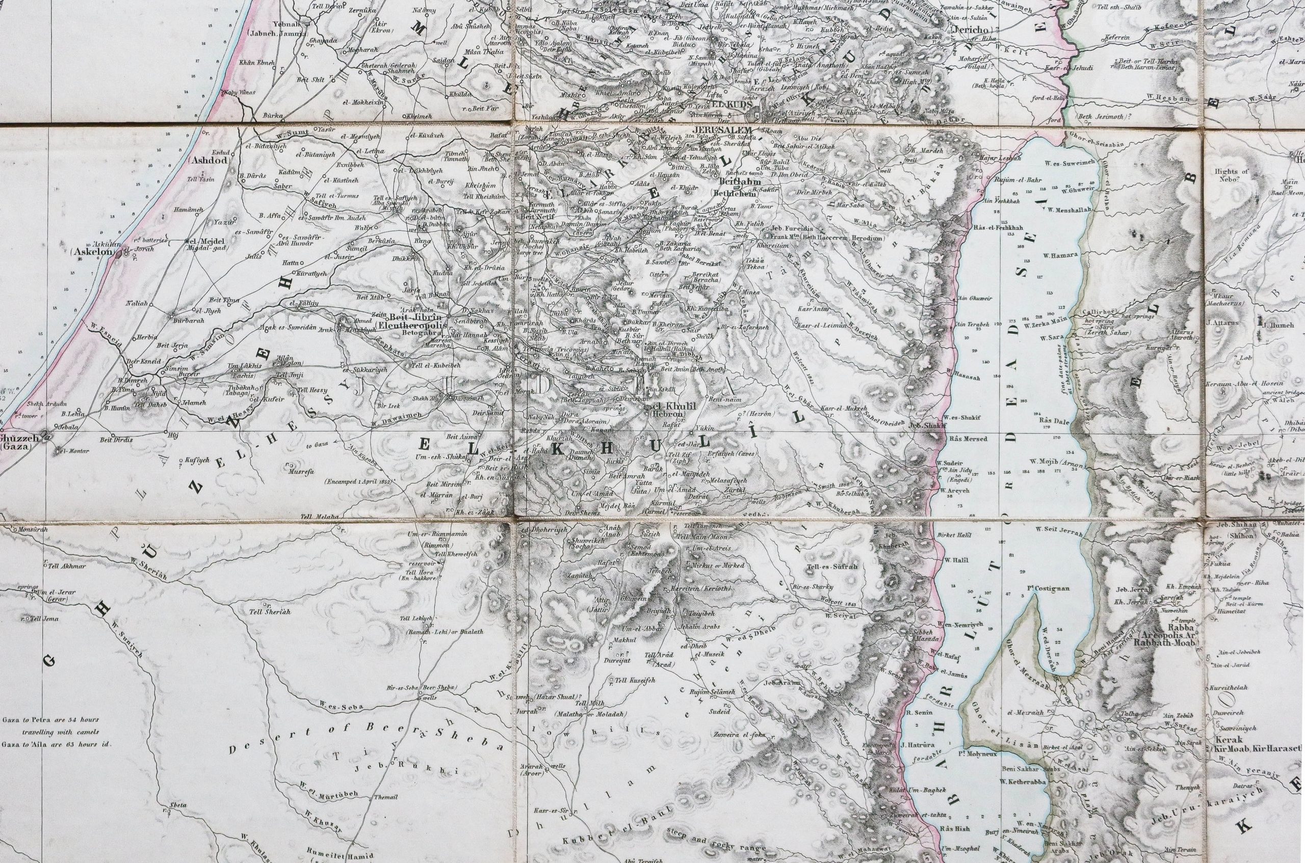
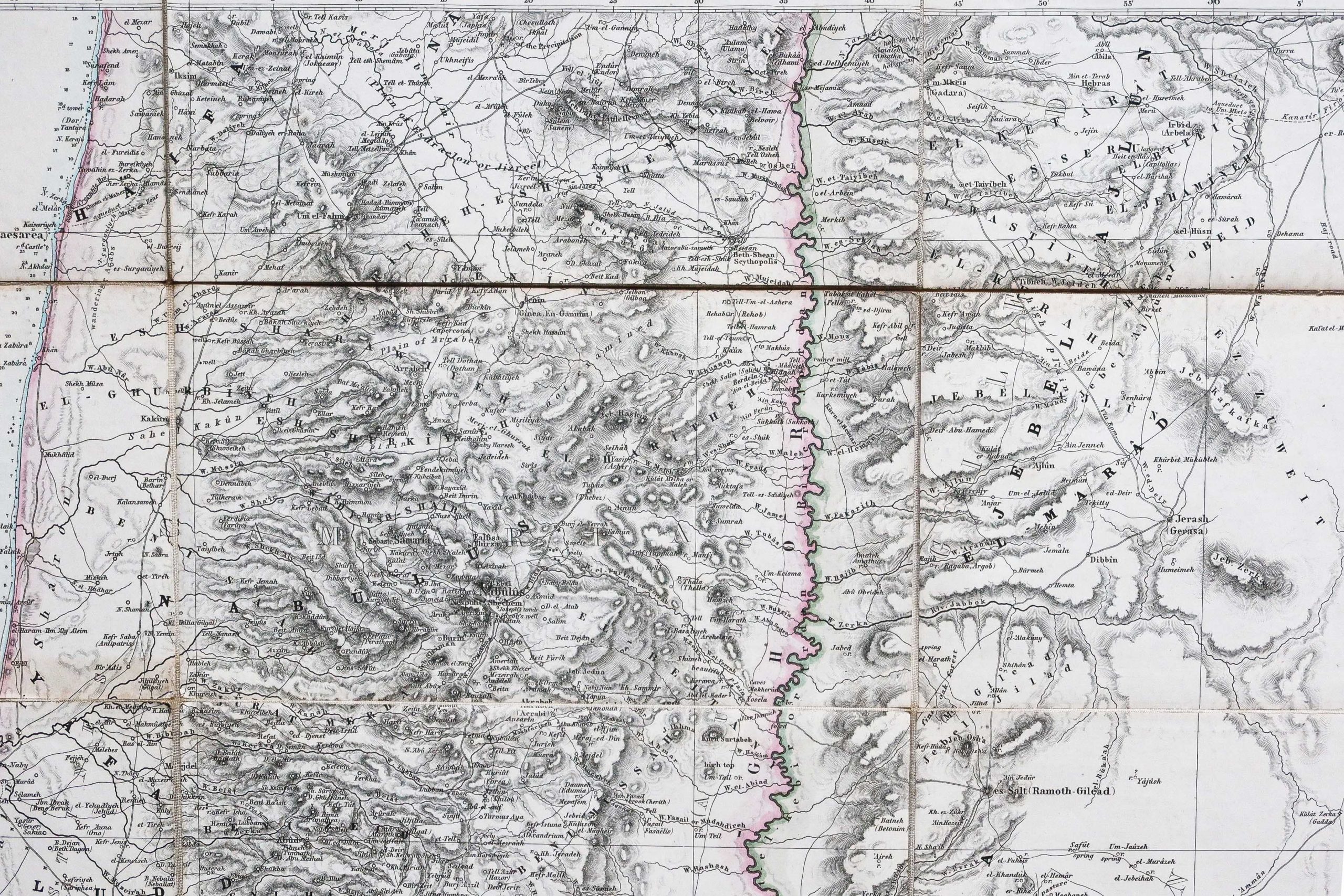
Map of the Holy Land / constructed by CWM Van de Velde, late Lieut. Dutch RN Officr. Oaken Crown, Chevr. Legion of Honor, & c. from his own surveys in 1851, 52 & 62, from those made in 1841 by Majors Robe, Rochfort, Scott & Lieut. Symonds, RF from the triangulations made in 1860-62 under direction of Commndr. AL Mansell, RN and from the researches of Robinson, Wetzstein and other travelers.
Original map made in 1865. Van de Velde cartographer.
2 vintage canvas cards in 30 sections each.
Colored boundaries of the time.
Format of each card: 87 x 71 cm.
In a perfect state.
Colored boundaries of the government of Beirut, Damascus and Lebanon.
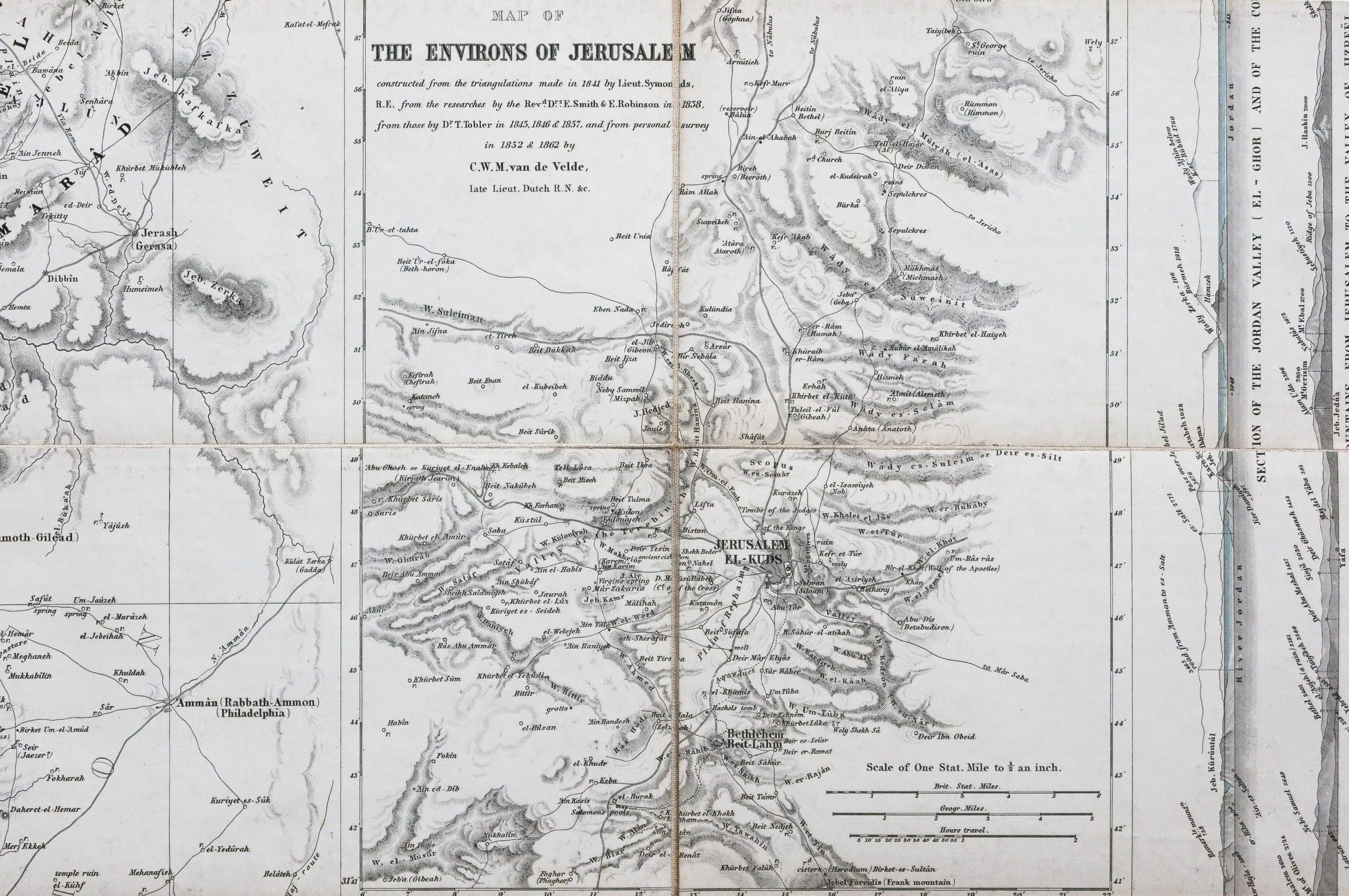
A cross section over the entire height of the 2 maps, 2 inserts showing the 1862 map of the surroundings of Jerusalem and the new plan of Jerusalem by Van de Velde from 1864.
Map recognized as the most important of the 19th century. Van de Velde first made a new map of Jerusalem. Alone, with a 7-inch surveyor's compass, without theodolites (which required several people to operate) and without making astronomical observations (which took a long time). Despite this, his map was considered the most accurate at the time, and on his return from his trip to Palestine, he was able to obtain the survey data from the Royal Engineers of 1840 and used them in the production of his new maps. .Considering the shortcomings of existing English cartographies, Van de Velde drew up his map, comparing the data with his work as well as all known prior geographic and cartographic knowledge. Yehoshua Ben-Arieh said: “Ritter's handwriting and the map of van de Velde together can be seen as the culmination of fifty years of exploration and research in the geography of Palestine and the Holy Land. "
You can consult all the maps, books and engravings available in your region by clicking on the link of our website specializing in ancient geographic archives:
https://cartes-livres-anciens.com/categorie-produit/cartes-geographique-anciennes-original-antique-maps/moyen-orient/moyen-orient-moyen-orient/
Secure payment by credit card on our website:
https://cartes-livres-anciens.com/produit/cartes-geographique-anciennes-original-antique-maps/moyen-orient/moyen-orient-moyen-orient/original-antique-map-of-the-holy- land-van-de-velde-cartographer /
All our maps and engravings are accompanied by a certificate of authenticity.
Holy Land - old geographic map

Send to a friend


 +33(0)6 12 89 90 97
Contact Patrick Serouge
Patrick Serouge
www.cartes-livres-anciens.com
Marché Serpette
Allée 4 Stand 15
Allée 4 Stand 15
 pserouge@cartes-livres-anciens.com
 www.cartes-livres-anciens.com


