


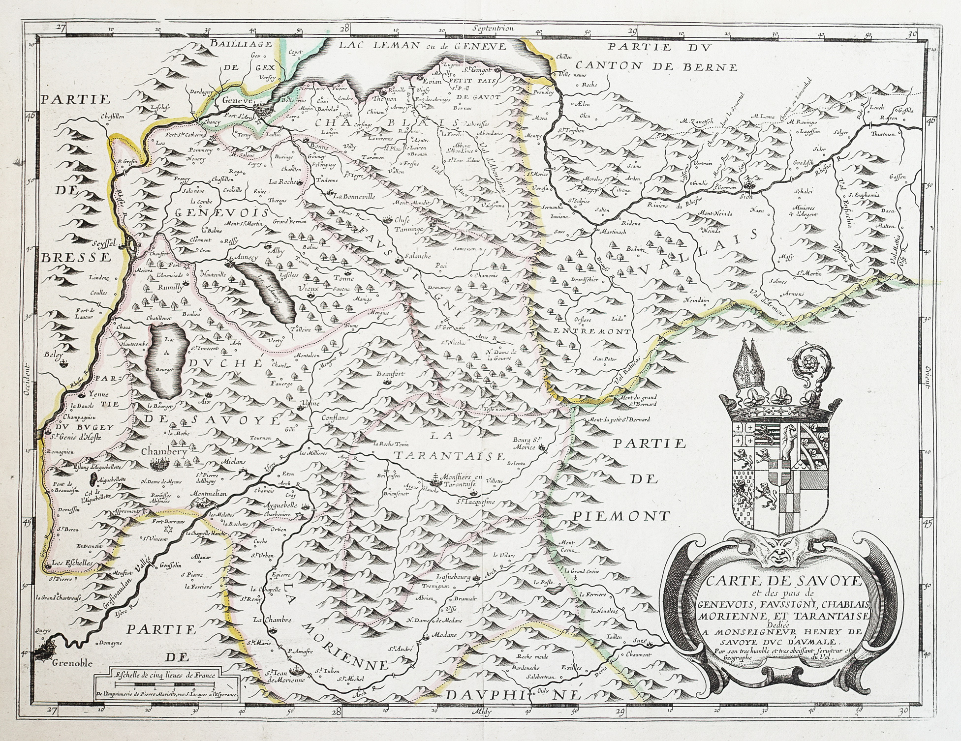
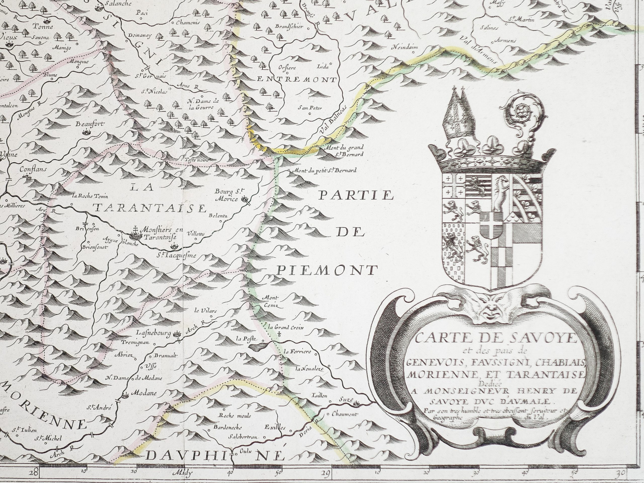
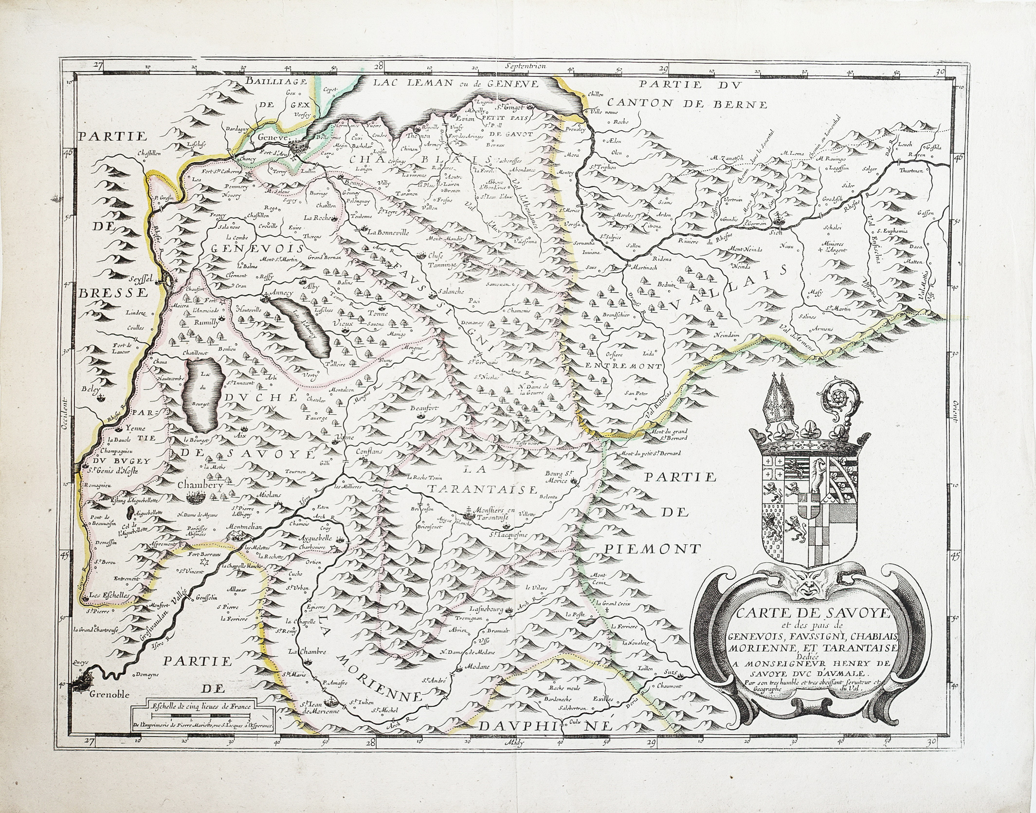
Original proof engraved around 1660. Pierre Duval cartographer.
Colored boundaries of the time.
Tiny freckle in the left side margin away from the map.
Very good state.
Sheet size: 54.5 x 43 cm.
Engraving format: 48 x 36.5 cm.
Original antique map around 1660.
Unusual map in French edition from the beginning of the 17th century. Elegant layout, large title block for regional coats of arms, scale of measurements.
You can consult all the maps, books and engravings available in your region by clicking on the link of our website specializing in ancient geographic archives: https://www.cartes-livres-anciens.com
Secure payment by credit card on our website: https://cartes-livres-anciens.com/produit/cartes-geographique-anciennes-original-antique-maps/europe/italie/carte-geographique-ancienne-de-savoie -Genevois /
Pierre Duval (1618-1683) was a French geographer, cartographer and publisher who worked in Abbeville and Paris in the 17th century.
Nephew of the famous cartographer Nicolas Sanson, from whom he learned the art and skills of the cartographer, the 2 men then worked at the royal court, following the King's request to bring together the crafts in Paris.
He made many new maps and atlases.
He was appointed “ Ordinary Geographer of the King” from 1650 and died in 1683.
His wife and daughters continued to work after his death.


 pserouge@cartes-livres-anciens.com
 www.cartes-livres-anciens.com


